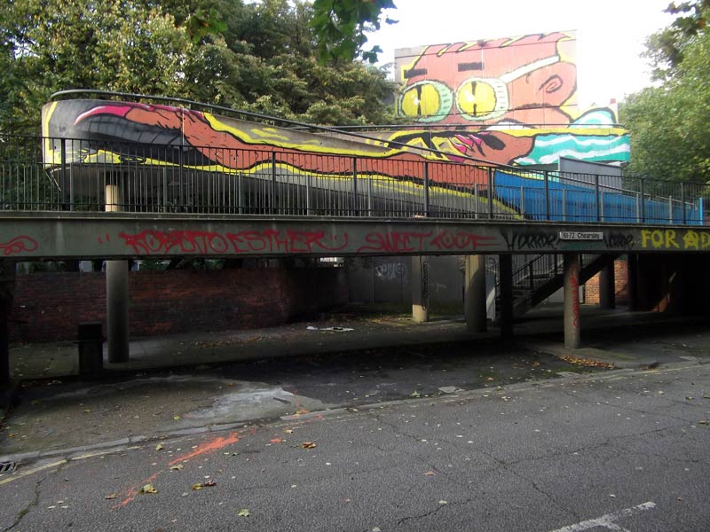
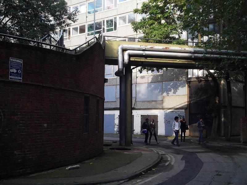
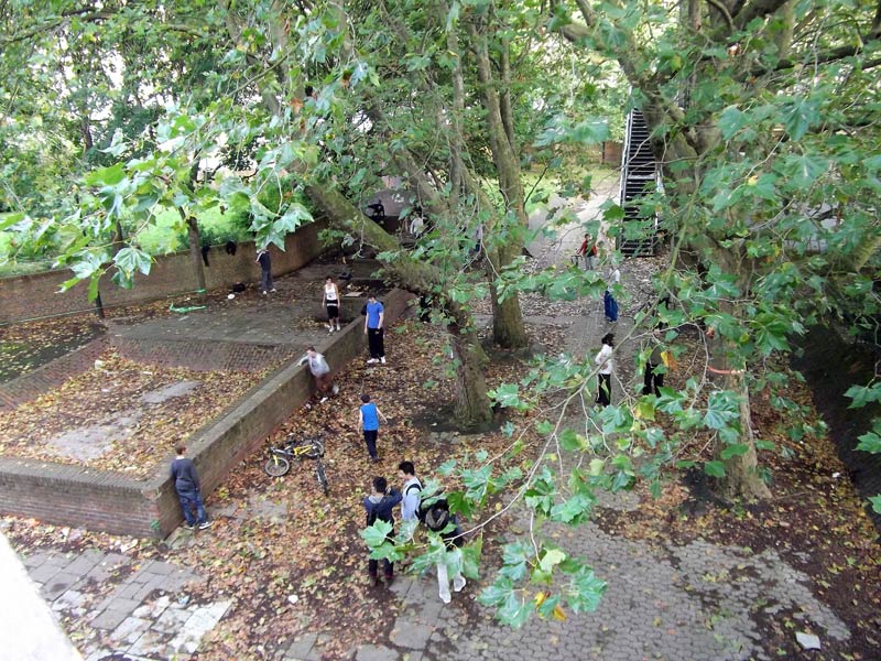
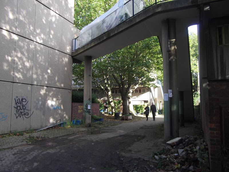
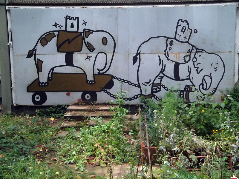
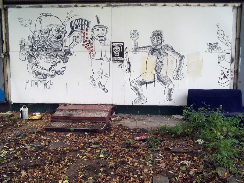
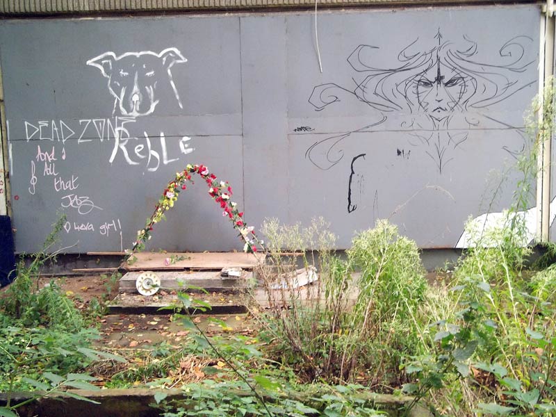
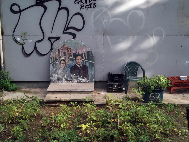
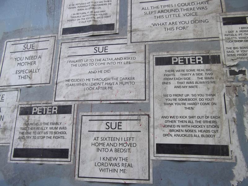
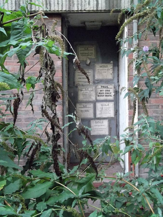
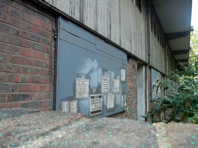
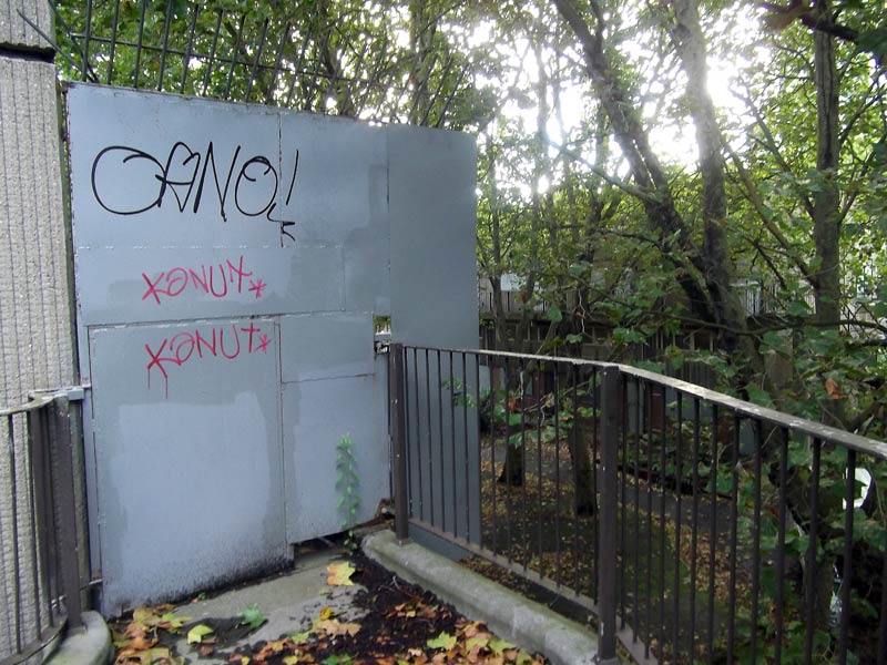
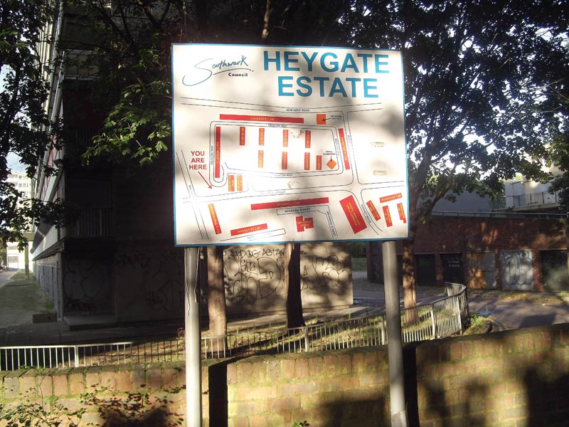
A journey with my camera through the soon to be demolished Heygate Estate in Elephant and Castle, London.
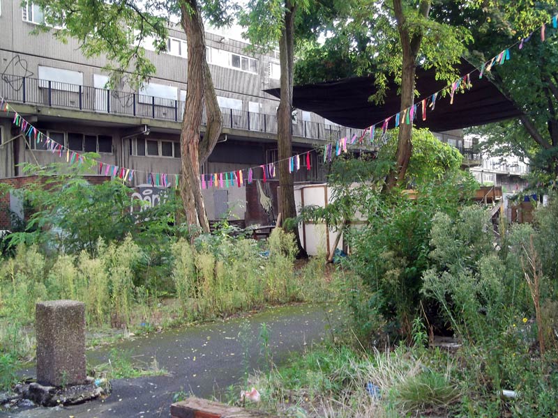
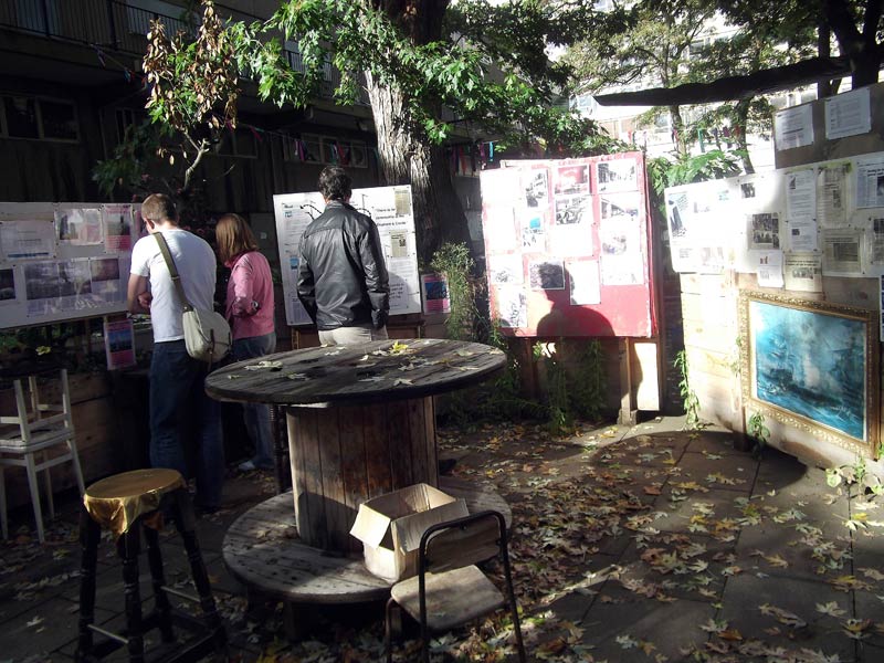
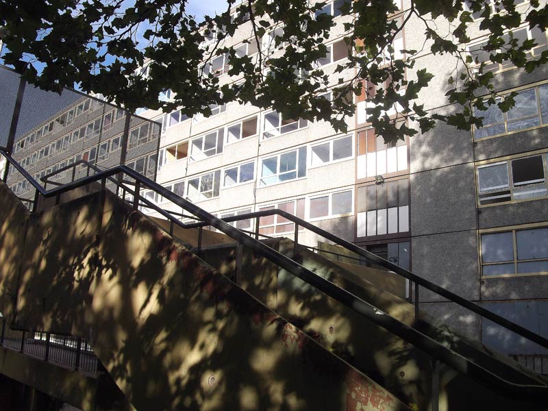
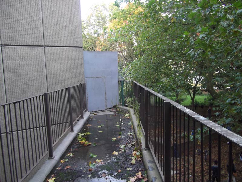
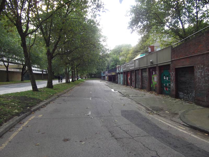
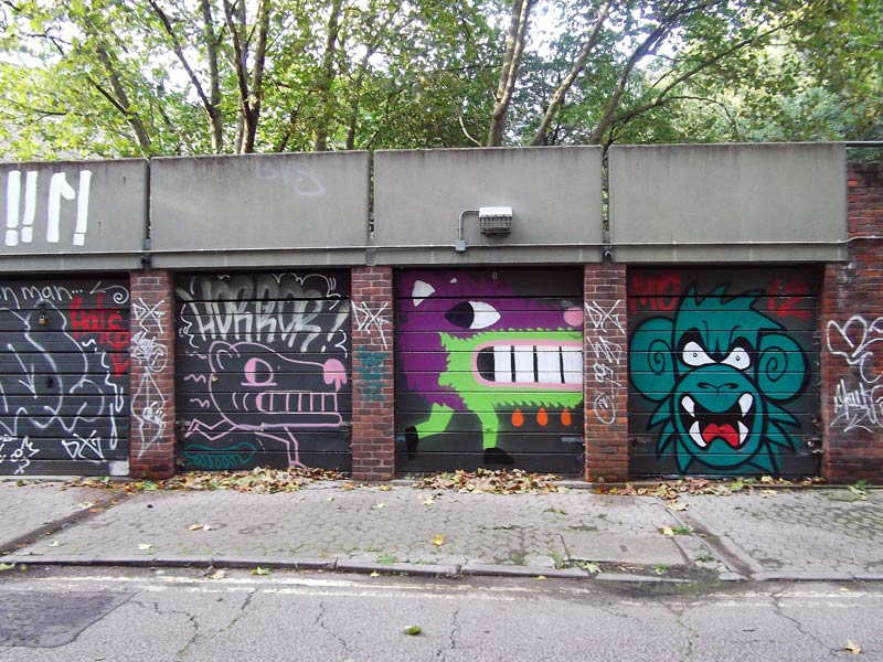
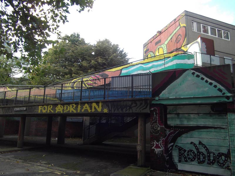
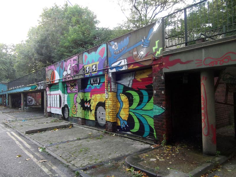
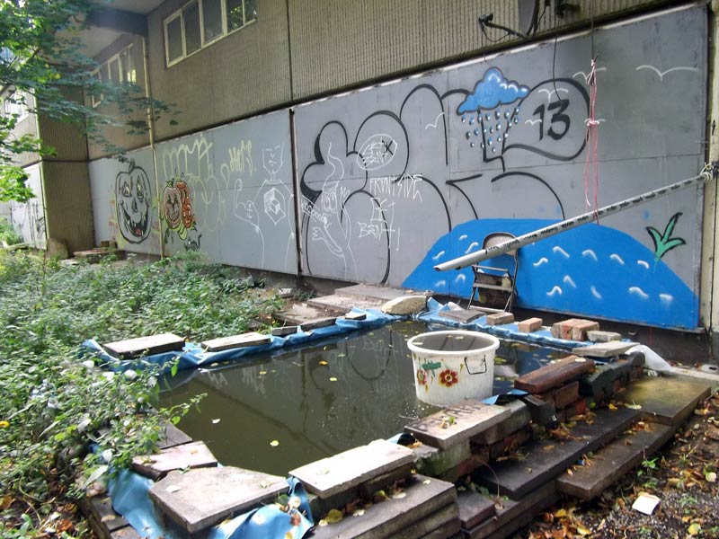
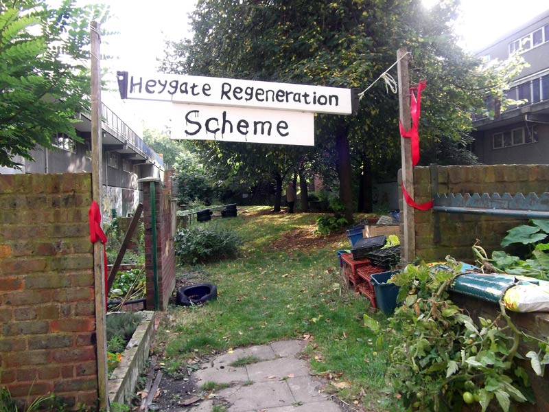
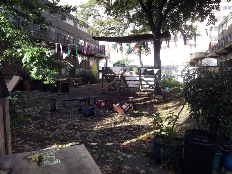
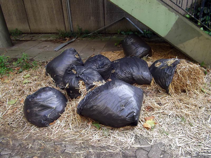
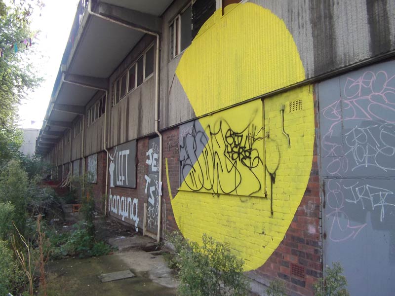
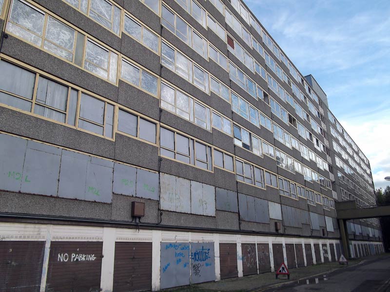
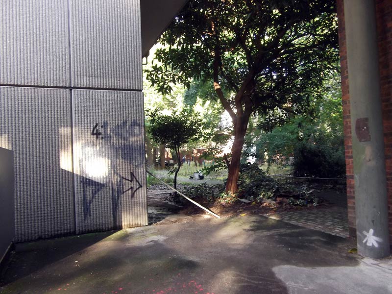
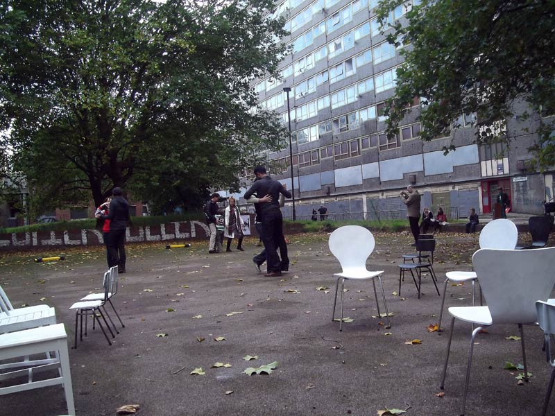
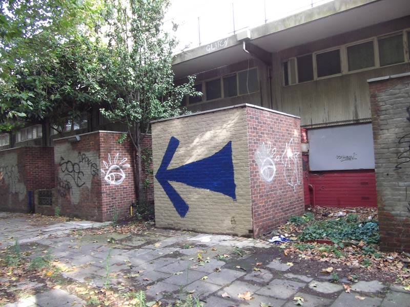
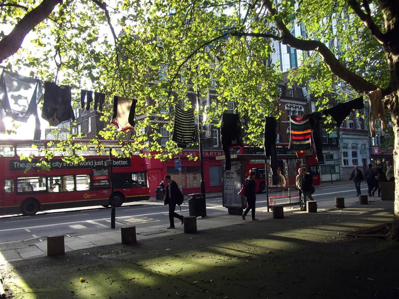
I visited 6th October and the Heygate Estate was also hosting a number of site-specific artworks as part of the Elephest festival, including Nadia Berri’s eerie and evocative performance piece, the Last Waltz. The estate is a well known site of Brutalist concrete 1970’s architecture that was home to around 3000 people, although the structure is reportedly still sound it is now marked for demolition as part of the regeneration of the Elephant and Castle area.
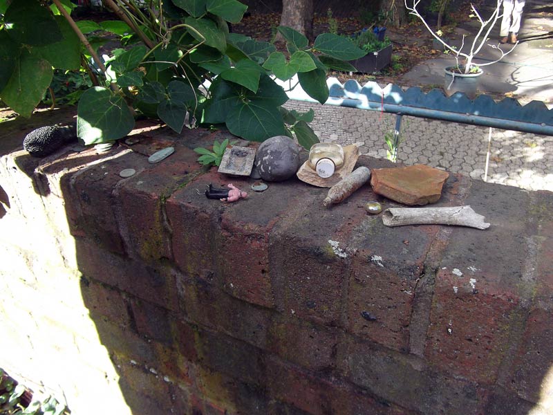
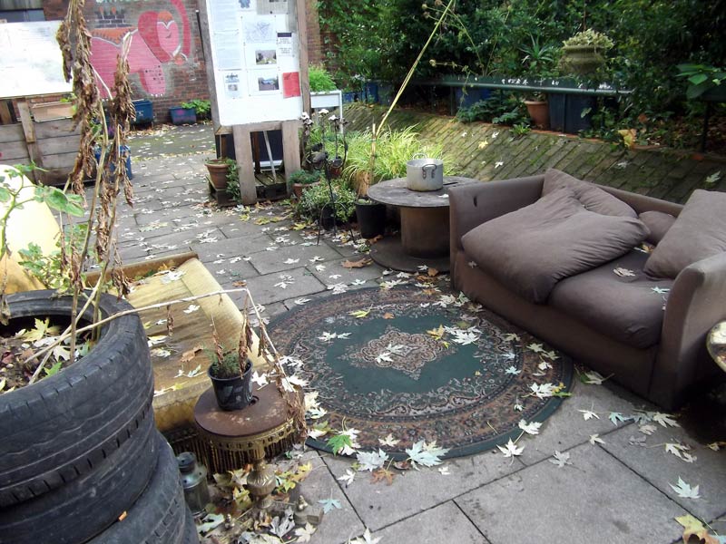
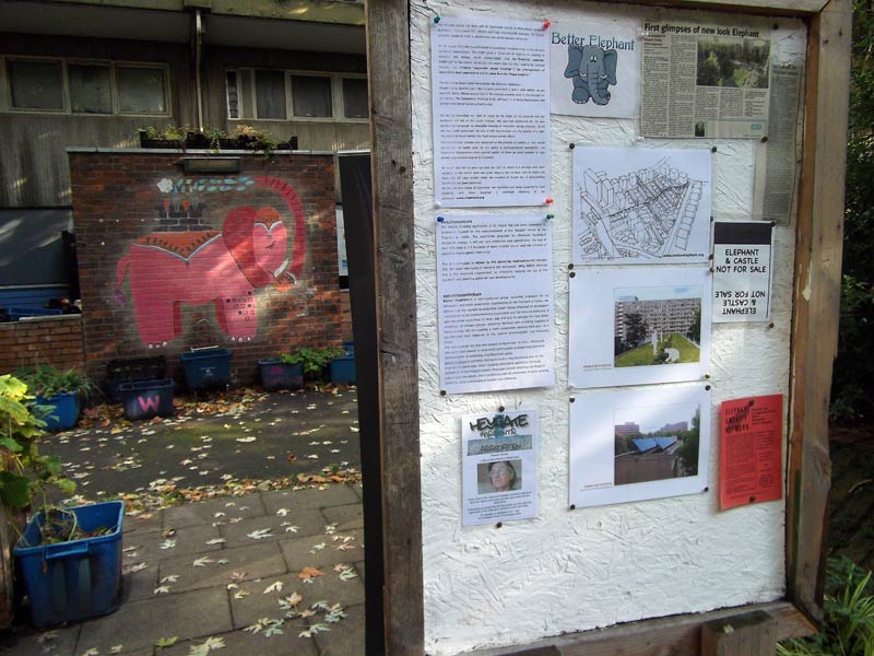
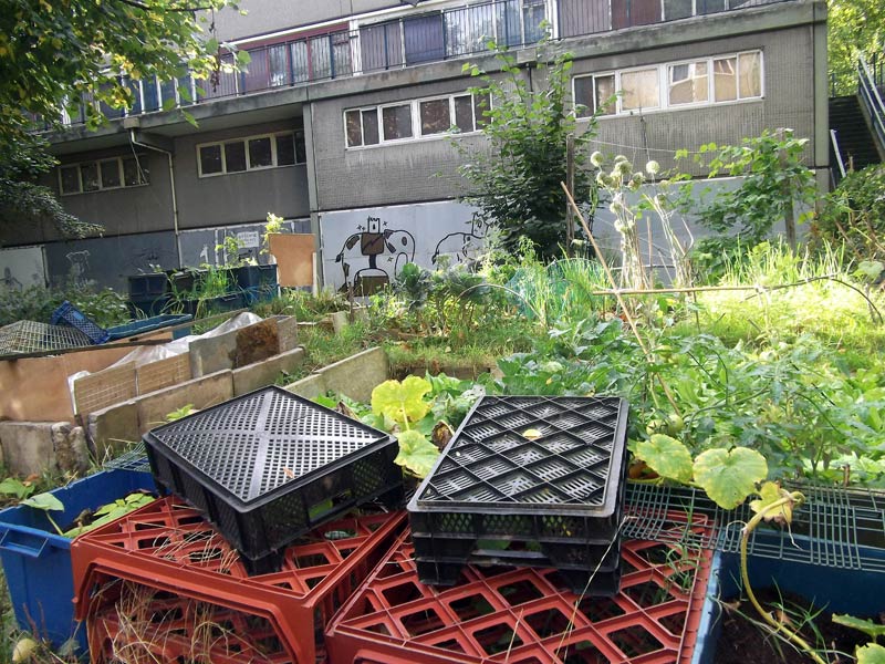
I was prepared to find a claustrophobic and austere place but was suprised by the number of trees, public space and also a sense of quiet seclusion away from the busy Walworth road outside. Graffiti & wall drawings, Parkour, (now) barricaded walkways, a community gardening project, inside-out furniture and long since discarded possessions all made for a visit steeped with human, and urban history.
Great fun during a collaborative filming event with artists Constantine Gras, Dee Harding and Nadia Berri in Latimer Road, West London. Shot nearby to the dramatic railway arches and under the famous Westway flyover, and in the soon to be demolished Latymer Projects HQ- A former nursery seeped with local history stretching back to the Notting Hill Race Riots in 1958.
Constantine’s short film Day Care will pay homage to the site and its intricate social and historical connections. I can’t wait to see the final cut!
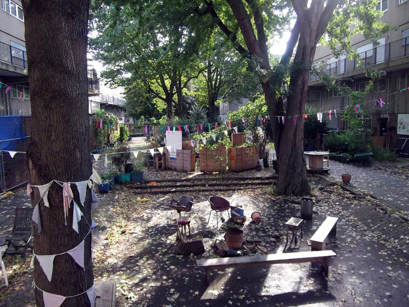
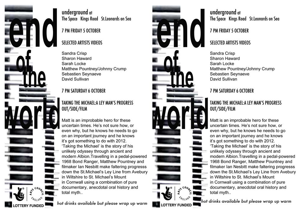
The outdoor screening will be a continuation of End of the World* installations curated and created by Sharon Haward and Sarah Locke for Coastal Curents Festival in Hastings 2012
Shanty towns, nomadic populations, scrapheaps awash with redundant products and technologies, ever-expanding, competing populations and the famous late-2012 assertions of the Mayan calendar have all been starting points for the show.
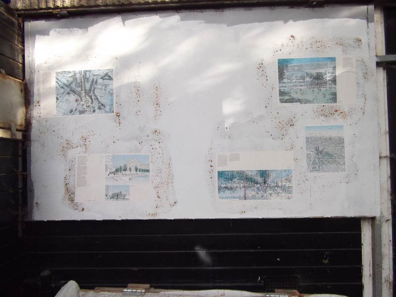
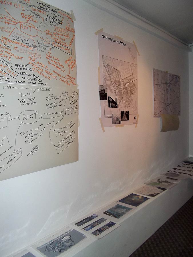
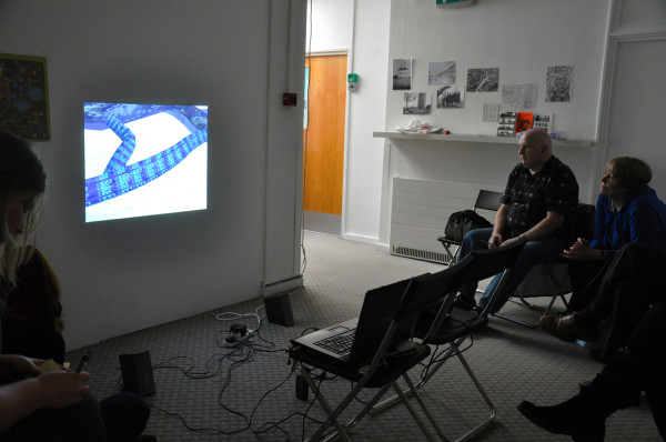
On Saturday 21st April I had the pleasure of working with London-based artists Constantine Gras, Natalie Marr, Alistair Ashe and Emily Ballard who kindly arranged the screening of my film Mapping London’s Subterranean Rivers at Laytmer Projects, 154 Freston Road, London W10.
The screening was followed by a short talk discussing how I made the film including varied research into the Subterranean rivers over a 6 month period, ranging from books, maps and walks across the urban landscape.
I also had the opportunity to bring along and discuss a large folder of maps, texts and images for the first time explaining my research process and how all the different strands eventually came together to make the film. (See shelf in this photo)
The screening formed week 6 of Latymer’s fascinating 7 week Mapping Project inviting members of the local community to contribute personal and historical accounts of local history whilst learning about open source mapping techniques. Varied and (sometimes infamous) local histories were recalled, particularly by Constantine, including the Notting Hill race riots of 1958.
Another local resident, Alan presented incredibly detailed drawings – plans of the area showing housing transformation over decades of change. He also had equally detailed knowledge of previous slum accommodation and areas which have since been cleared for social housing or much more upmarket property/gentrification.
Interestingly; I also learned that the lost subterranean river Counters Creek originated at a nearby source just south of St Quintin Avenue
[Counter’s Creek (or Chelsea Creek is a largely subterranean stream that arises in Kensal Green, west London and flows south into the River Thames on the Tideway at Sands End, Chelsea. Two small tributaries that rise just west of Ladbroke Grove enter the stream close to Latimer Road just south of St Quintin Avenue.] Wikipedia
A key discussion point was how maps simultaneously reveal and hide information depending on the intention of the map maker/ cartographer; that maps are not purely factual records as such but graphical representations of carefully selected data, created for many different reasons that may be socio-politically or economically motivated.
An unexpected outcome from this weeks session was the generation of sound cards (pictured above) containing direct written responses to my film from artists and local residents; these short records will contribute towards a new soundtrack for the film.
The positive thing about these thoughtful sound cards is that they provided great feedback and critique for the work from those who had viewed the film previously online, and from others who had not. Providing informal crit-style feedback that I had not experienced for some time
I really appreciated the perceptive feedback that this short exercise generated; each person touched upon different intentions within the work, some of which I had almost actually forgotten about, and some completely new and illuminating interpretations.
Including ideas such as: The ”organic city’, waterways as urban arteries, ‘violent’ river speeds and the potentially destructive potential of water in both natural and built environments. Alastair even came up with a full musical violin score for the work including the opening soundtrack for Hitchcock’s Psycho by Bernard Herrmann!
Flows _ could be something other than water
WORDS- flows of information
River as a live body
Sense of time
Speed
Construction/destruction
Chaos of change over time
Communities
Flows/barriers between communities
Tree
Root Breeze
Memory motion
Archive fragment
Fast running, violent
LANGUAGE – defines territory as much as maps, empirical data
–
Links: Open source mapping techniques and links covered during the session
Here are two mini-print versions 21 cm x 20cm of large digital drawings for Lessedra Mini Print Annual, Sophia Bulgaria 2012 (Invited artist), printed on Somerset enhanced Satin inkjet paper.
They will be posted to Bulgaria for the exhibition very soon….
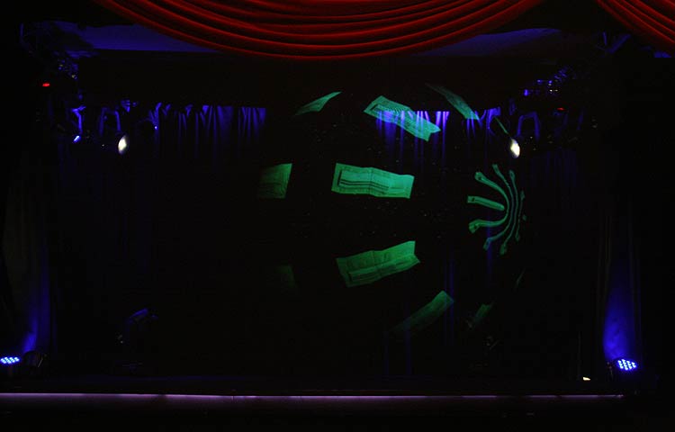
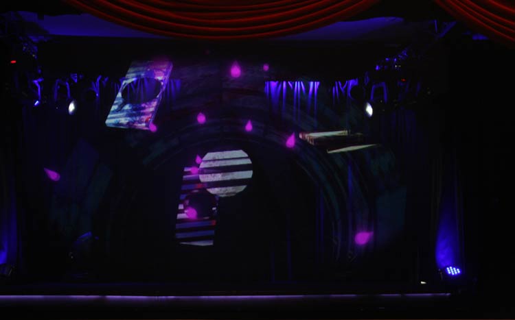
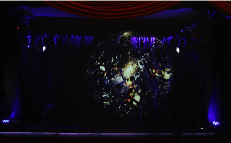
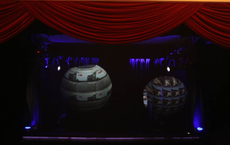
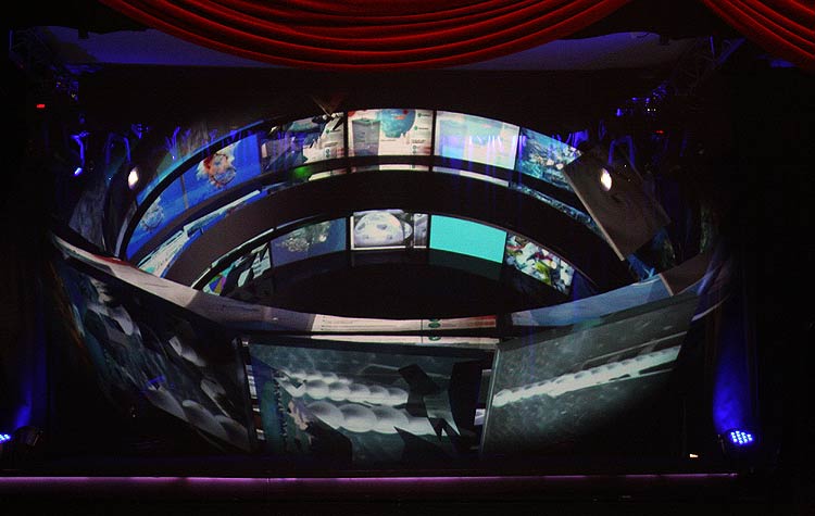
An edited version my film Oceanics was exhibited as an exciting holographic projection work this year at Kinetica Art Fair, AmbikaP3, London. 9th – 12th February 2012
Holographic performances will be on the Musion stage at the following times
Thursday 9th at 5pm
Sunday 12th 1-2pm
Each day 10-11am
The projection system is run by Musion Systems Ltd and is based on a Victorian illusionist technique known as Pepper’s Ghost. High definition digital images in motion appear 3D on a specially constructed stage. To give an idea of scale, the image projection area on stage is approximately 4 metres wide and 2.5 metres high.
Notes: Rethinking Oceanics audio track for holographic projection at Kinetica art fair. Also, Scenes to be used as holograms need to be placed on a black background for the effect to work as a hologram
One of my large format digital prints ‘The Bigger Picture’ has been selected for a really interesting future group exhibition entitled ‘This ‘Me’ of Mine’ curated by artist and writer Jane Boyer.
‘Myself’ is a loaded pronoun, it is a pronoun which is grammatically suggestive of a self reflected back on itself through actions or thoughts. It represents my person as I sit here writing this, my past which has brought me here where I sit and write, and the potential of what may happen next. It is a multiplicity of selves, changed and influenced by time, experience and encounters all woven together in the weave of a fabric called ‘me’. Yet there are two sides to a piece of fabric, just as there are two sides to me: my interior self and my exterior self.
Participating artists include: Aly Helyer, David Riley, David Minton, Annabel Dover, Sarah Hervey, Anthony Boswell, Kate Murdoch, Cathy Lomax, Melanie Titmuss, Edd Pearman, Sandra Crisp, Julie Cockburn, Shireen Quershi, Jane Boyer.
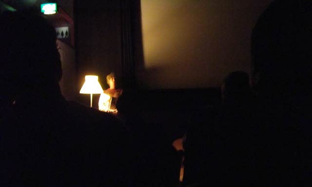
My film Mapping London’s Subterranean Rivers will be installed on loop in the Lexi Cinema foyer as part of In Short film festival – A digital festival showcasing local short films and soundscapes November 20th: From 2pm to 5pm. I went along to view the selected entries for this local festival open to both amateur and professional filmmakers…..
Large comfortable armchairs await visitors to the Lexi Cinema in Kensal Rise North London. Personal touches such as the retro standard lamp to illuminate speakers introducing the festival line-up make this boutique cinema unique in character, the tiny bar served a tea and home made cakes in the interval.
A great line up of 15 films from diverse genres created by both amateur and professional filmmakers made for a really entertaining couple of hours viewing including abstract animation, social documentary and comedy to name a few. The jury voted 2 films into joint first place; ‘Forgotten Carers’ by Matthew Wolpert – An hilarious take on the single life of a man left by his girlfriend for being too high maintenance.
‘The Dog Smells You’ (James Wright) a contemporary, haunting & ambiguous journey using continually shifting colour, filters and textures – filmed in one day using an i-phone. The audience prize went to (Island) ‘Murmuration’ by Sophie Windsor Clive. My personal favorites for InShort festival include; Constantine Gras’ Bound for Glory ‘A poignant docudrama about a woman who stitches together memories of her West Indian mother.
The Money Shot – a film by Graham Rathlin: ‘An ebayer discovers his new camera has magical qualities that could make hime extremely rich’ …with a twist at the end! And finally, 2 young filmakers Marco Pini & Daniel Lubin presented Day 56 a film shot in Wales imaging a world where there are suddenly no people. The judges were; Jack Arbuthnot, Joanna Hogg, Martina Amati and Tora Young, the winning films will be screened before the main program each day at the Lexi during the forthcoming week.
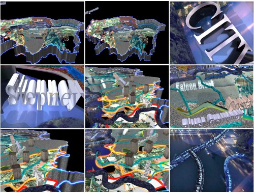
This post looks at some of the process involved in making my recent videoMapping London’s Subterranean Rivers including a few wireframe screen-grabs from the work which illustrate how work- in-progress appears within the open software window when work is in-progress.
The video was created using Maya Autodesk which is a 3D animation program offering extensive tools for modelling, dynamics, visual effects and rendering.
I found this software quite difficult to grasp initially, as the interface and layout is very different to regular video editing software. Maya does contain an animation timeline but most other features seemed almost like learning a new language, very different. I finally discovered a small corner of the program where I could operate creatively and develop ideas, and experiment.
The main difference between Maya and 2D animation or video editing software is that the artist can construct 3D objects in virtual space in Maya. Once models have been created and placed on the ‘stage’ multiple cameras are set up to film the 3D object from as many different viewpoints or angles as desired.
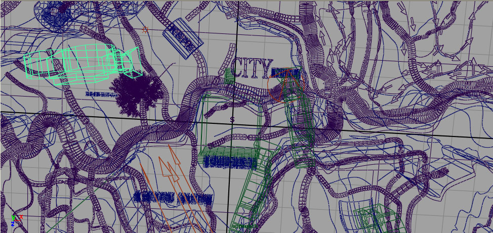
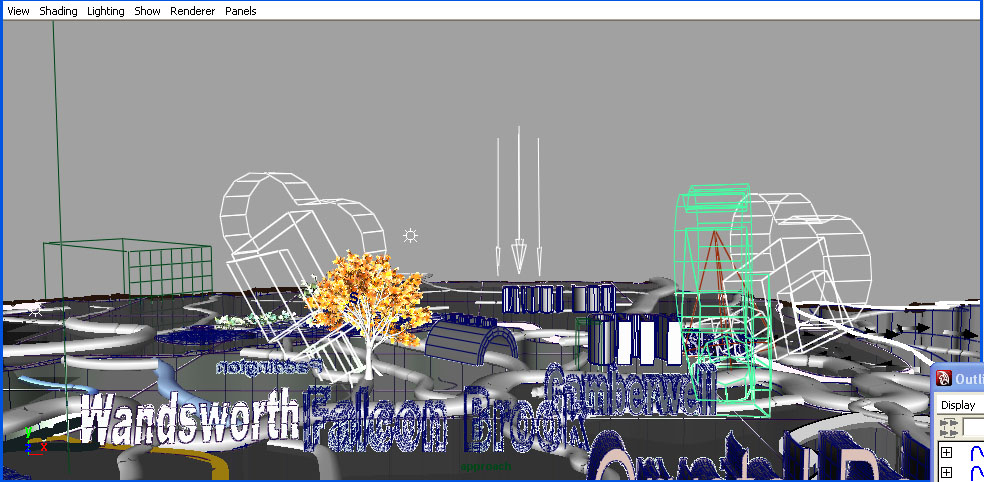
For this video, only 1 3D map elevation was ‘drawn’ in Maya and various cameras (coloured in green) positioned around it to record and create different viewpoints/ scenes within the video.
(Above) Wireframe scene in Maya showing a section of the 3D map created for Mapping London’s Subterranean Rivers. This is an aerial view showing the City, river Thames and various subterranean rivers and overground ancient tributaries.
Using wireframe views of the scenes in Maya enables more rapid rendering, editing, rotating and viewing of the scene in real time. Maya takes up a lot of processing power and RAM and this viewing mode means that work can be speeded up a little. The drawback is that it is rather like working in the dark as colour, texture etc is not visible while you are working.
To view full texturing and colour whilst working in Maya, frames need to be rendered individually. I find doing this now and again is enough to retain in memory exactly what the scene looks like and how it will appear later after the final rendered sequence for video is created.
This kind of view shows a little more detail when working within the software window than is available in wireframe mode – Some solid areas are displayed to highlight more of the model’s detail. This aerial view is used right at the start of the video when the camera begins to descend onto the map.
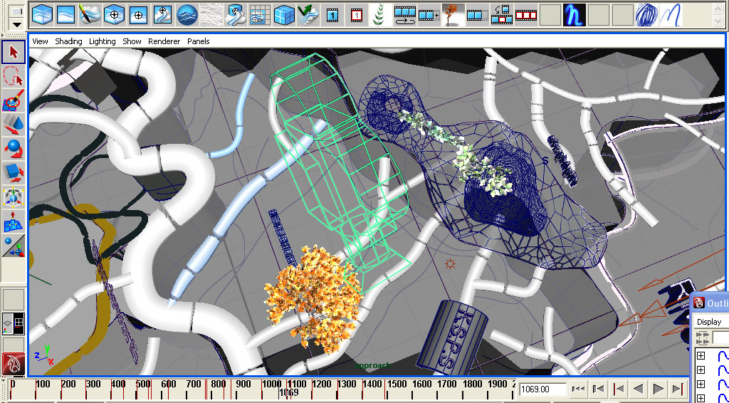
Near the centre of the map can be seen a yellow textured object which is a 3D model tree, later assigned a ‘wind dynamic’ so it appears to be swaying quite strongly in a gust of strong wind. Many other dynamics are available in Maya to simulate gravity and movement iof water or ocean waves, for example. Used a flowing water dynamic to simulate the River Thames in the final work.
The red cone-shape to the left and solid grey cube-like objects positioned bottom-left on the map, depict the placement of lighting object (spotlight) and architectural buildings respectively.
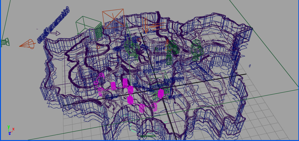
Aerial view showing the King’s Scholars’ Pond Sewer (KSPS) – near bottom centre of the image Highgate hill (blue wire frame object) and the Thames to the left (Wiggling, thicker, solid white line object) Side view showing cameras, tree & 3D signage depicting London place names Another aerial wireframe view The cluster of bright pink, solid shapes are tower block buildings in the video.
It is not possible to see fully-detailed, textured image sequences until frames are fully rendered and exported from Maya, either directly into Quick Time. Or as a series of TARGA (individual images, 24 or 25 frames per second of footage) files which can then be imported into video editing software such as After Effects to create a moving image sequence.
AS previously mentioned, a quick and dirty view of any individual frame can be viewed (very slowly) live within Maya by using the IPR renderer, but testing out a full animated sequence is beyond the processing power of my rather humble PC.
However, I do enjoy working somewhat in the dark with this process as it allows for certain unexpected results that would not be possible otherwise. A certain Serendipity…
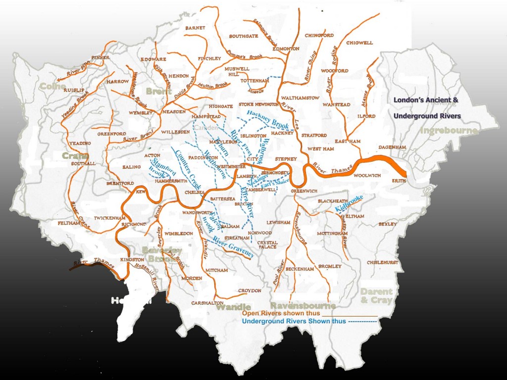
This is a composite map that I created from 2 different maps. Showing the Thames and various tributaries, many of which are now underground or completely lost. It formed the template to create the 3D map in the film. Please see previous post for more information about this map…
I’ve uploaded here a composite map created as research for my video Mapping London’s Subterranean Rivers 2010 and described briefly how it was made and used within the work.
(Above) Composite map based upon ‘Tributaries of the Thames from Kingston to Erith‘ from Nicholas Barton’s well known book entitled The Lost Rivers of London.
The underground rivers are marked in blue and the ancient or lost overground waterways appear in orange. The various rivers on the composite map formed a template to (fairly) accurately place the underground rivers onto the 3d map within the animation program to create the video Mapping London’s Subterranean Rivers
I digitally overlaid the map ‘Tributaries of the Thames from Kingston to Erith‘ onto another more contemporary map of Greater London that shows the borough boundaries and depicts the distinctive outline shape of Greater London.
In doing so, I noticed that the shape of London resembled an island cut adrift. This is not intended to be a super accurate map, more a poetic interpretation.
This island-like form inspired the 3d model elevation of London in the video, depicting London as cutout sculptural form suspended in empty virtual black space.